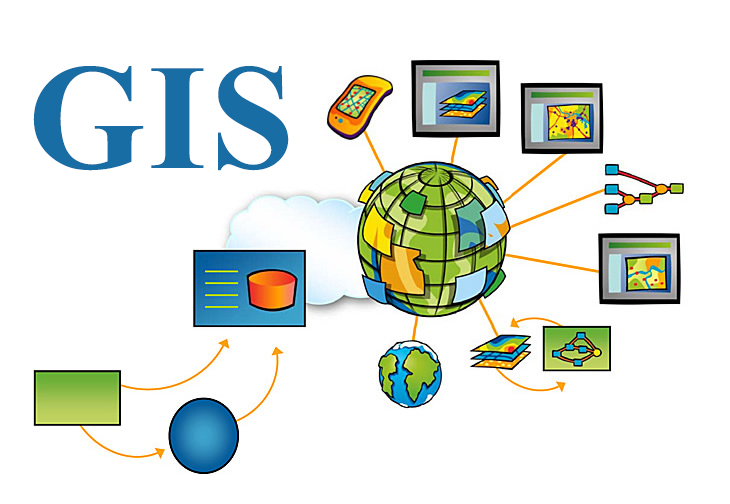
The main aim of this course is to provide students with an introductory yet comprehensive overview of Geographical Information Systems (GIS).
It looks at the importance of geographic information in understanding and managing resources, while introducing you to powerful tools and concepts you can use to pose and solve spatial questions, It also provides an opportunity to improve basic GIS skills with computer based examples on creating, editing and visualizing geographical data. Moreover, it explains basic terminology about global and local coordinate systems, database development and analyzing for better urban planning and architectural design processes.
Students must be clear that this is not a class specifically on any particular GIS application. It is a course on the underlying theories and concepts in GIS. The understanding of these concepts and theories together will help students to perform spatial analysis in a GIS application properly and efficiently.
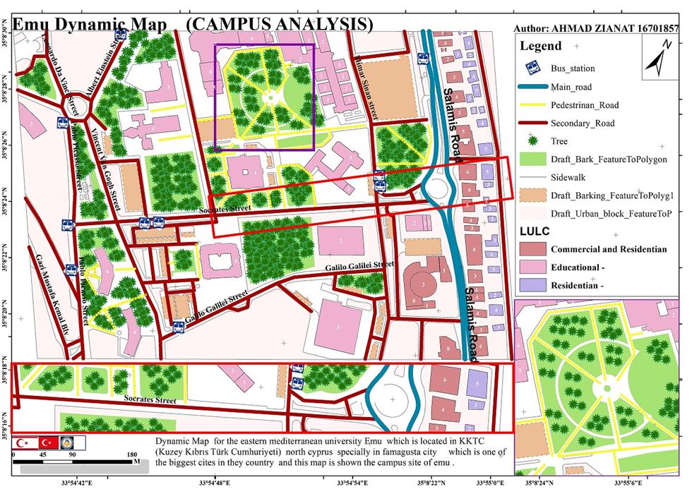
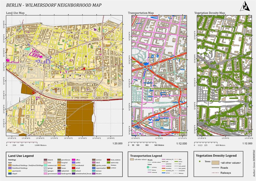
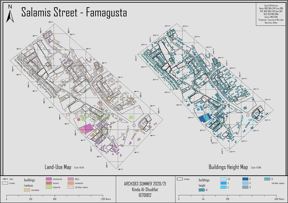
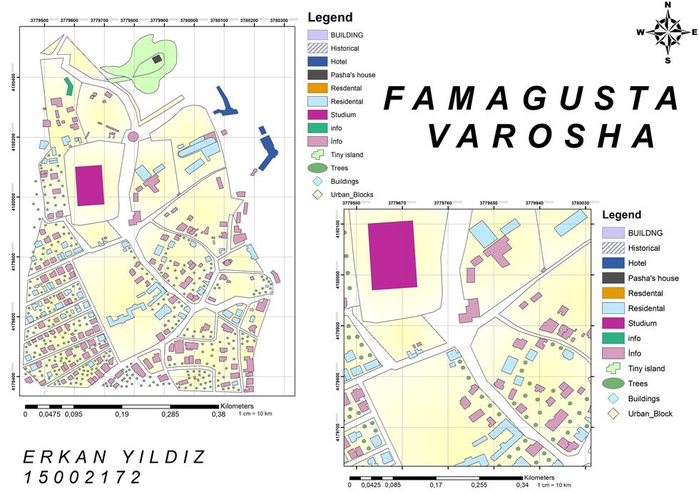
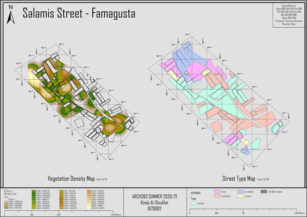
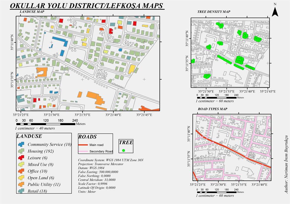
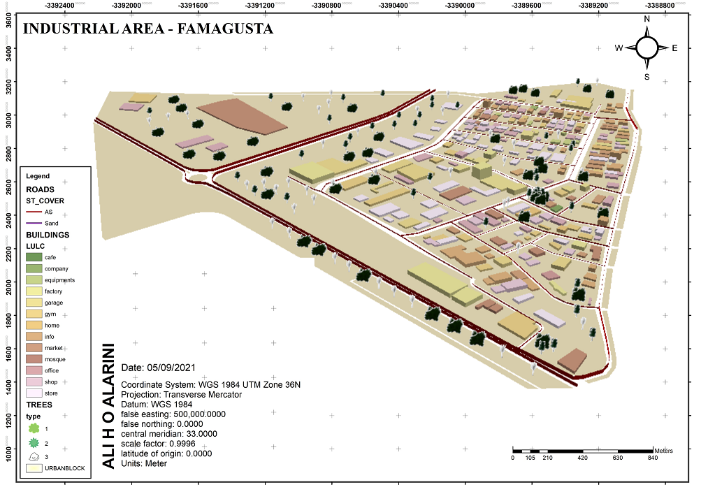
Students will be guided through: data creation, data input, attribute creation, data editing and, visualization, analysis and presentation of geographic information using ESRI’s ArcGIS software.
***Please always following the announcement / Lütfen her zaman duyurulari takip ediniz***